


Mgrs & Utm Map Pro: Tactical
4.7125.00 Reviews
App Specs
- Version
- 7.9.26
- Updated On
- License
- $24.99
- Downloads
- 10,000+
- Developer
- DakikTech
- Categories
- Maps & Navigation
- Platform
- Android, iOS
Screenshots
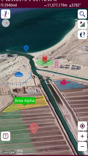
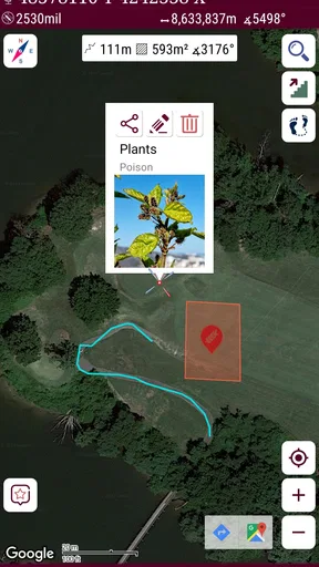
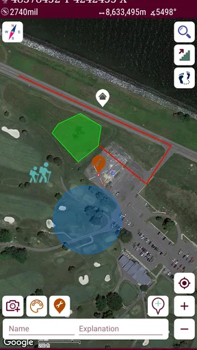
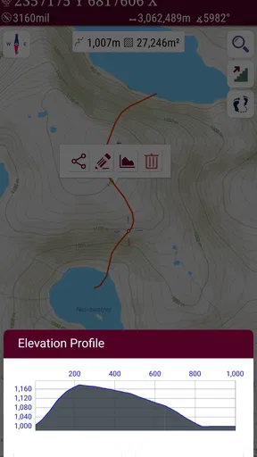
 Analysis by AppCompare
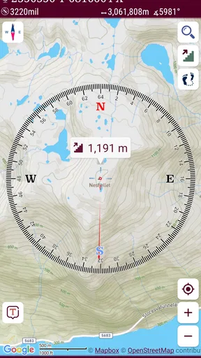
I judge a coordinate map less by how many routes it offers than by whether it helps me move between the grid reference in my hand and the place under my feet. That is the useful idea behind Mgrs & Utm Map Pro: it is a navigation helper built around coordinate systems, including MGRS, UTM, and degrees, minutes, and seconds. If you have ever tried to compare a military-style grid reference with the latitude-and-longitude display on a regular map, you can see why that focus matters.
Coordinate work, rather than turn-by-turn driving
This is an Android maps and navigation app from DakikTech, and its purpose is more specialized than the usual road navigator. The emphasis is on reading and working with coordinates, not on giving drivers a polished sequence of lane instructions or finding shops along a route. I would think of it as a field companion for people who already have a location, a map, or a grid reference to work with.
That distinction is important before paying for it. The app costs $24.99, so I would not buy it just because I want another everyday map for commuting. Its audience is narrower: hikers using grid-based maps, people who exchange MGRS or UTM locations, and anyone whose navigation task involves comparing coordinate formats. It has an Everyone age rating, but the specialized vocabulary still makes it most useful to people who know why they need those formats.
Why switching coordinate formats matters
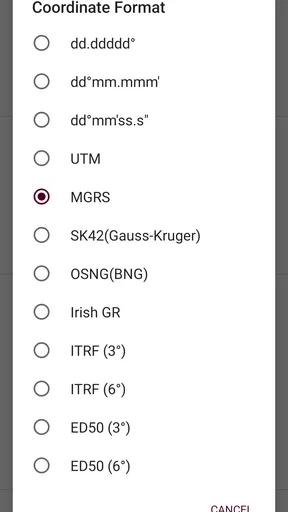
Coordinates are only helpful when everyone involved can interpret them the same way. A paper map, a field assignment, and a phone may express a location differently. Moving between MGRS, UTM, and DMS in one map-focused tool can reduce the awkward step of manually translating a reference before checking it against the map. That is the app’s clearest practical value, not simply having another digital map on screen.
For example, if a hiking partner sends a grid reference but you are used to latitude and longitude, the useful workflow is to inspect the location in the format you recognize and then compare it with the surrounding map. The reverse is equally relevant when a group’s printed material uses a grid system but someone has shared a coordinate in another form. I would still read every digit carefully: a conversion tool can make formats easier to handle, but it cannot correct a mistyped or incomplete reference.
How I would use it in the field
I would prepare before setting out, rather than treating the phone as a last-minute rescue. If I had a route sheet or a set of destinations, I would check the coordinate format in advance, confirm that each reference appears where I expect on the map, and make sure the people I am meeting are using the same location. That small check can prevent a common field mistake: everyone has a coordinate, but not everyone is talking about it in the same system.
A realistic use might be a weekend walk where the group plans to meet at a trail junction marked by a grid reference on a printed map. One person can compare that reference with the phone’s map view, while another uses the location in a different coordinate format. Instead of guessing that two differently written positions are equivalent, the group can check them against the same geographic point. For this kind of coordination, the app’s specific focus is more valuable than a general map crowded with driving features.
Worth Reading Before You Choose

Flipboard Shows What News Apps Must Do Beyond the Feed

Switching to Android Auto Means Rethinking Your Driving Routine

Google Calendar Makes a Crowded Week Easier to Manage

Ludo King Makes the Most of the Minutes Between Plans

Baby Panda World Brings Quick Play to Modern Phones, but Its Game Library Feels Busy

ESPN’s Live Game View Makes Following Close Games Easier
There is also a sensible role for it at a desk or at home. Before leaving, I could use a coordinate map to check a point sent by a friend, make sure it is in the intended area, and write down the reference in the format the group will use. That is often a better time to notice a missing digit or a misunderstanding than when people are already outdoors and trying to regroup.
Where it differs from ordinary map apps
Most people reach first for a familiar navigation app because it makes street addresses, driving directions, and nearby services easy to understand. Those apps are the better choice when the destination is an address and the main question is how to get there by road. A paper topographic map, meanwhile, gives a broad view that does not depend on a phone display and is useful for understanding terrain at a glance. This app belongs between those choices: it is for working with coordinate references on a digital map, not a replacement for every map or navigation need.
That specialization has a trade-off. If you do not recognize MGRS, UTM, or DMS, the main appeal may feel abstract, and the price is hard to justify for occasional address searches. If you routinely receive grid coordinates, however, a normal road map can make the crucial task—checking that exact reference—feel secondary. I would choose the tool based on the coordinate system required by the trip, not on the assumption that one app should handle every kind of navigation equally well.
Useful habits and practical limits
My most useful tip is to agree on a coordinate format before sharing locations. A group can avoid needless back-and-forth by saying whether it is exchanging MGRS, UTM, or DMS, then checking a reference on the map before relying on it. This is especially worthwhile when one person is working from printed material and another is using a phone. Coordinate precision is only useful when the precision and format are understood by both sides.
I would also keep a second source of orientation for any trip where losing phone access would matter. A phone map is convenient, but battery, reception, and conditions in the field can all affect how useful a phone is. The original review describes offline maps, saved places, and location sharing; those can be handy parts of a trip workflow, but I would not make the phone my only plan for a remote outing. Carrying an appropriate paper map and knowing how to read it remains a sensible backup.
Another practical trade-off is screen scale. A coordinate can identify a precise point, but that does not automatically tell you whether the approach is safe, accessible, or sensible. I would use the map to verify the location and then consider the terrain and route independently. For field work, that distinction matters: a correct point is not the same thing as a complete navigation plan.
Who gets the most from it
The best fit is someone who handles grid references often enough to value a dedicated coordinate workflow: a hiker matching a paper map, a geocacher comparing location formats, or a field professional who needs to interpret coordinates. It can also suit a group that shares locations in more than one format. The reported 4.7 average from around 1.9K ratings and more than 10K installs suggest that people have found a use for it, though I would still base a purchase on my own need for coordinate tools rather than popularity alone.
I would skip it if I mainly want free, straightforward directions to restaurants, workplaces, or street addresses. I would also hesitate if I only need to convert a coordinate once in a while; at $24.99, that occasional task may not warrant a dedicated purchase. The app is a more convincing choice when coordinate conversion is part of regular navigation, not a feature that sounds interesting but will rarely be opened.
The current version is 7.8.0, and it requires Android 6.0 or later. Those details are worth checking against an older phone before buying, especially if the device is one you keep as a backup for outdoor use. The developer is DakikTech, and the app has been available since Apr 9, 2018. I would still make sure the device and the coordinate workflow suit the trip rather than assume that an app’s age or version number answers those practical questions.
My take after weighing the fit
When I first opened Mgrs & Utm Map Pro, I was pleasantly surprised by its clean and intuitive interface. No unnecessary frills here—just pure functionality. You can tell right away that this app is designed with the user in mind, focusing on ease of navigation and accessibility. If you're a fan of simplicity, you’ll feel right at home.
Features That Stand Out
Now, let’s talk features. What really sets this app apart is its ability to convert coordinates into different formats. Whether you’re dealing with MGRS, UTM, or latitude and longitude, this app has you covered. It's perfect for hikers, geocachers, and even those involved in professional fields like surveying or the military.
Another cool feature is the offline map capability. You know those times when you’re deep in the woods, and your phone gives you the dreaded "no service" message? Well, with the offline maps, you don’t have to worry about losing your way. Just download the maps you need beforehand, and you're good to go.
Ease of Use
Let’s face it, no one wants to spend ages figuring out how to use an app. Luckily, Mgrs & Utm Map Pro is incredibly user-friendly. With just a few taps, you can input coordinates, switch between map views, and even share your location with friends. It’s so straightforward that even my tech-challenged uncle could figure it out.
One thing I really appreciate is the app's responsiveness. No lagging or freezing, just smooth sailing. This is especially important when you’re out in the field and need quick, reliable information.
Personal Experience
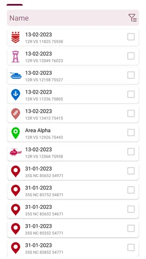
So, I took this app out for a test run on a recent hiking trip. I was impressed by how accurately it pinpointed my location, even when I was off the beaten path. The coordinate conversion feature was a lifesaver when I was trying to match my location with a paper map. Plus, being able to save my favorite spots for future reference was a nice touch.
Sharing my location with friends was seamless. They could track my progress and meet up with me without any hassle. It’s little things like this that make the app not just functional, but genuinely enjoyable to use.
Final Thoughts
In a world where there are countless mapping apps available, Mgrs & Utm Map Pro certainly holds its own. It’s not just about getting from point A to B, but about doing so with confidence and ease. Whether you’re a seasoned adventurer or just someone who likes to wander, this app is a fantastic tool to have in your arsenal.
The reliability and versatility of Mgrs & Utm Map Pro make it a standout choice for anyone who needs precise and user-friendly mapping capabilities. So, if you’re on the hunt for a mapping app that won’t let you down, give this one a try. You can download it from your favorite app store and start exploring with peace of mind.
Pros
- Highly accurate location data.
- Easy-to-use interface.
- Supports multiple coordinate systems.
- Offline map access.
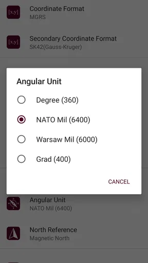
- Customizable map settings.
Cons
- Limited free features.
- Steep learning curve for beginners.
- Requires regular updates.
- No real-time navigation.
- Limited customer support.
FAQs for Mgrs & Utm Map Pro: Tactical
What is Mgrs & Utm Map Pro used for?
Mgrs & Utm Map Pro is a navigation app designed for professionals and enthusiasts who require precise location tracking. It supports Military Grid Reference System (MGRS) and Universal Transverse Mercator (UTM) coordinates, making it ideal for use in military, surveying, and outdoor activities. The app provides detailed maps and accurate positioning features.
Is Mgrs & Utm Map Pro available offline?
Yes, Mgrs & Utm Map Pro offers offline map capabilities. Users can download maps for specific areas beforehand, allowing them to access critical geographical data even without an internet connection. This feature is particularly useful for users in remote locations or areas with poor network coverage.
How user-friendly is Mgrs & Utm Map Pro for beginners?
While Mgrs & Utm Map Pro is packed with advanced features, it is designed to be user-friendly. The interface is intuitive, with clear instructions and easy navigation. Beginners can access tutorials and help sections to understand basic functionalities, making it accessible for both novice and experienced users.
What are some key features of Mgrs & Utm Map Pro?
Mgrs & Utm Map Pro includes features such as real-time GPS tracking, custom map styling, and coordinate conversion between MGRS, UTM, and latitude/longitude. It also supports waypoints and track recording, which are essential for planning and executing navigation tasks. These features cater to a wide range of mapping needs.
Are there any subscription fees for Mgrs & Utm Map Pro?
Mgrs & Utm Map Pro is a paid application, typically requiring a one-time purchase to download. However, there are no recurring subscription fees. Users should confirm any additional in-app purchases for specialized features or updates that may incur extra costs.


